The trail closest to most Carmel Valley front doors closed on a Tuesday in September. Fire didn't close it, and neither did rain. California State Parks closed it to run gas, water and sewer lines. A few miles inland, Los Peñasquitos Canyon Preserve burned twice this summer and lost more than 230 acres at its west end. Its trails reopened on Oct. 2.
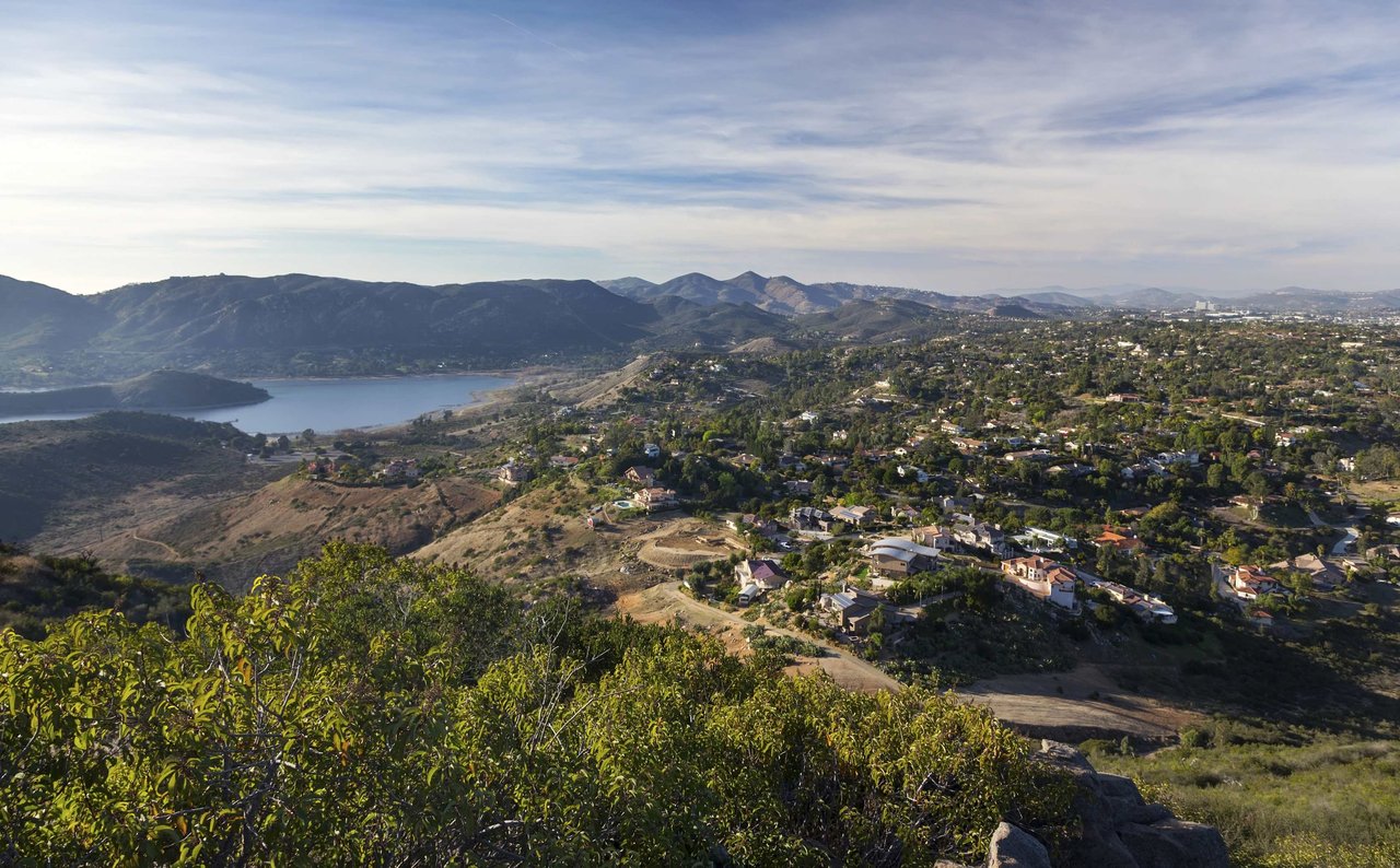
Until March, the default fall hike in 92130 is no longer the bluff above the ocean. It's a canyon floor marked with yellow rope, a mesa where you can look across at the reserve you can't enter, and a smaller section of Torrey Pines whose status State Parks lists two different ways.
What closed on Sept. 22, and what stayed open
The State Parks project page sets out the sequence. The reserve road closed to vehicles on Monday, Sept. 21, along with the Lodge and the Trail Interpretive Kiosk in the west lot. Starting Tuesday, Sept. 22, the reserve closed to all visitors, "including pedestrians, bicyclists and vehicles," and that covers every trail, the Beach Trail Staircase, the Lodge and both upper parking lots.
This is Phase II of a utility project. Crews are installing new gas, water, wastewater and communication lines, adding accessible parking stalls, and building an accessible path from the upper lot to the restroom and Lodge. They are also replacing the park road from the west parking lot to the reserve's south boundary. State Parks says the reserve is scheduled to reopen in March 2027. The Torrey Pines Docent Society puts the date at approximately March 1.
State Parks splits the work into phases because of the California gnatcatcher. Construction stops during the bird's nesting season, so the project runs in winter blocks instead of all at once. Phase I ran from November 2025 through February 2026. The same page says the facilities being rebuilt serve more than 4 million visitors a year. That gives a sense of how many hikers are now looking for somewhere else to walk.
Here's what remains open on the coast:
- Torrey Pines State Beach
- The North Beach parking lot
- The South Beach parking lot
State Parks doesn't refund passes during a closure. The Union-Tribune reports that passes remain valid at all other state parks.
The Extension, listed two ways
The Torrey Pines Extension is the part of the reserve on the Carmel Valley side, reached from Del Mar Scenic Parkway off Carmel Valley Road or from Mar Scenic Drive and Mira Montana Drive off Del Mar Heights Road. The Docent Society's trail map names the Mar Scenic, Margaret Fleming Nature, DAR, Red Ridge and West Ridge trails, and it marks the trailhead "Street parking only." That map dates to 2009, so curb conditions may have changed since.
During Phase I, the Extension trails stayed open the whole time. For Phase II, State Parks says two different things. Its Park Information page shows this current-conditions panel:
TPSNR Main Trails: CLOSED TPSNR Extension: OPEN
The Phase II project page, last updated Sept. 18, 2026, says the closure includes "all trails" and makes no exception for the Extension. The Docent Society's notice also lists no exception. Until State Parks clears this up, call the reserve at (858) 755-2063 before walking up Del Mar Scenic Parkway. Whatever the Extension's status, dogs are not allowed anywhere in the state natural reserve, and that includes the Extension.
Carmel Mountain looks across at the closed reserve
If the Extension turns out to be closed, Carmel Mountain Preserve is the closest coastal-sage hike to most of Carmel Valley. The City lists parking off Del Mar Mesa Road, Fairport Way and Shorepoint Way. Its curfew rules make all recreation in the preserve day-use only. A long-running local trail guide starts its loop at Ocean Air Recreation Center, with stairs leading up from the northwest corner of the lot.
Published loops run about 2.7 to 3.1 miles, depending on the route. The best stop this season is a bench viewpoint. It looks over Peñasquitos Lagoon toward the sculpted cliffs on the eastern edge of Torrey Pines. The closed reserve is in full view from the bench. A trail report posted Oct. 2, 2026 described the paths as dry and dusty, with good views.
For a shorter walk, Crest Canyon Open Space Park, on the Del Mar side of the lagoon, has a 1.15-mile easy trail with Torrey pines and a loop. It has street-parking trailheads near Racetrack View Drive and at Durango Drive and Lozana Road, and no facilities. Coming from Carmel Valley, these short hikes reach the same trees and lagoon edge that drew people to the reserve.
The canyon that burned is the one that reopened
Los Peñasquitos Canyon Preserve is the big inland option. The City describes it as roughly seven miles long and about 4,000 acres, with a waterfall, a live-oak forest along the creek, sycamores and marsh habitat. The County counts about 12 miles of trails. Its posted address is 12020 Black Mountain Road, with park hours from 8 a.m. to sunset.
This summer was hard on the canyon. A Sept. 13 update from a City park ranger, posted by the Friends of Los Peñasquitos Canyon Preserve, said two fires in June and August left scars totaling more than 230 acres in the west end. The fires damaged the North and South Main Trails, Sidehill, and Big and Little Waimea. At that point, everything from the waterfall to Vista Sorrento Parkway was still under a Fire Department evacuation order, and every trail west of the waterfall was closed.
On Oct. 2, the Friends posted a senior park ranger's update saying all authorized trails were officially open again. The update said rangers are seeing more animal activity in the west end. It also said yellow rope fencing through the burn scar marks the authorized trails and protects regrowth. Short, targeted closures will continue while San Diego Fire-Rescue crews work on access roads.
For Carmel Valley hikers, the waterfall is the main draw. The City's directions recommend starting at the Park Village Road trailhead and following North Main Trail about 1.3 miles to the falls. That route now passes through the part of the canyon that burned, on the newly fenced trails. Other entrances include the east staging area at Black Mountain and Mercy Roads, a west staging area on Sorrento Valley Boulevard, and a south entrance at Camino Ruiz neighborhood park.
The canyon has rules that the bluff-top reserve doesn't need:
- Dogs are allowed on a leash no longer than eight feet.
- Trails close during rain and for at least 48 hours afterward. The Park Ranger Office at 858-538-8066 has current trail status.
- The County may close the trail staging area during and after storms.
The first rule of the rainy season will come up a lot before Torrey Pines reopens in March. A wet weekend can take Los Peñasquitos out for the following Monday and Tuesday too.
At the east end of the canyon, the Los Peñasquitos Ranch House at 12122 Canyonside Park Drive gives a hike some history. The County dates the original adobe to 1823, when Ruiz built it. The grounds and trails are open 8 a.m. to sunset daily, the museum is open Friday through Tuesday, and guided tours run Saturday and Sunday.
A canyon calendar through November
The Friends group's event listings already cover the rest of the closure season:
- Saturday, Oct. 17, 10 a.m. to 3 p.m. The Friends' "Arch in the Park" booth at Canyonside Park Driveway. This is a festival booth, not a guided hike.
- Saturday, Nov. 7, 8 to 10 a.m. The Camino Ruiz Rim-to-Creek hike with naturalist Beth Mather, starting at 11489 Camino Ruiz. The route drops down a steep, shaded set of switchbacks to the creek.
- Saturday, Nov. 28, 7:45 a.m. An easy birding walk with ornithologist Jeanie Anderson. It meets at the preserve sign at the west end of Canyonside Park Driveway.
Restoration is also part of the picture. The Friends have reported seven active restoration sites at the west end, including grassland and western monarch habitat work, in the same stretch of canyon where the summer fires burned. For anyone who wants to walk the burn scar with a guide, the November walks are the scheduled chance before the reserve reopens.
When you get to know a neighborhood by its trailheads, you learn things a listing sheet leaves out, like which streets park easily on a Saturday morning or how long a walk it is from the front door to the Ocean Air stairs. If trail access is part of how you're weighing your next move in Carmel Valley, 4S Ranch or Santa Fe Valley, Peter Heines can walk you through how specific streets connect to these preserves. Book a Consultation.